OGC API Tiles
QGIS
QGIS does not natively support the OGC API Tiles standard.
However, 2 options are possible:
- Use the mvt format when calling the API
- Use the underlying GDAL drivers to establish a connection to the API
QGIS supports OGC API Vector Tiles via the Vector Tiles Layer. Although OGC API - Tiles are not natively supported, you can customize the generic connection in order to access them in QGIS.
Access OGC API Tiles as mvt from QGIS
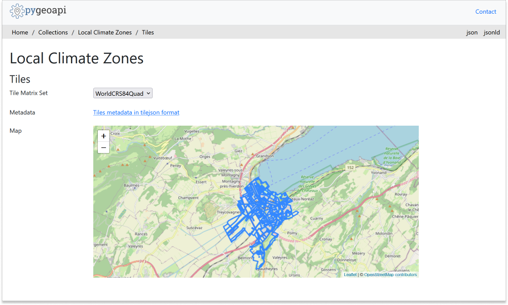
Before entering QGIS, access your pygeoapi installation page on the browser and follow these steps.
- access the collection page of the tiles dataset:
https://ogc.heig-vd.ch/pygeoapi/collections/ogcapi-tiles - navigate to the tiles page by clicking on
tiles:https://ogc.heig-vd.ch/pygeoapi/collections/ogcapi-tiles/tiles - click in
Tiles metadata in tilejson format:https://ogc.heig-vd.ch/pygeoapi/collections/ogcapi-tiles/tiles/WorldCRS84Quad/metadata - note the URL in
tiles:https://ogc.heig-vd.ch/pygeoapi/collections/ogcapi-tiles/tiles/WorldCRS84Quad/{tileMatrix}/{tileRow}/{tileCol}?f=mvtand of the values of minZoom and maxZoom
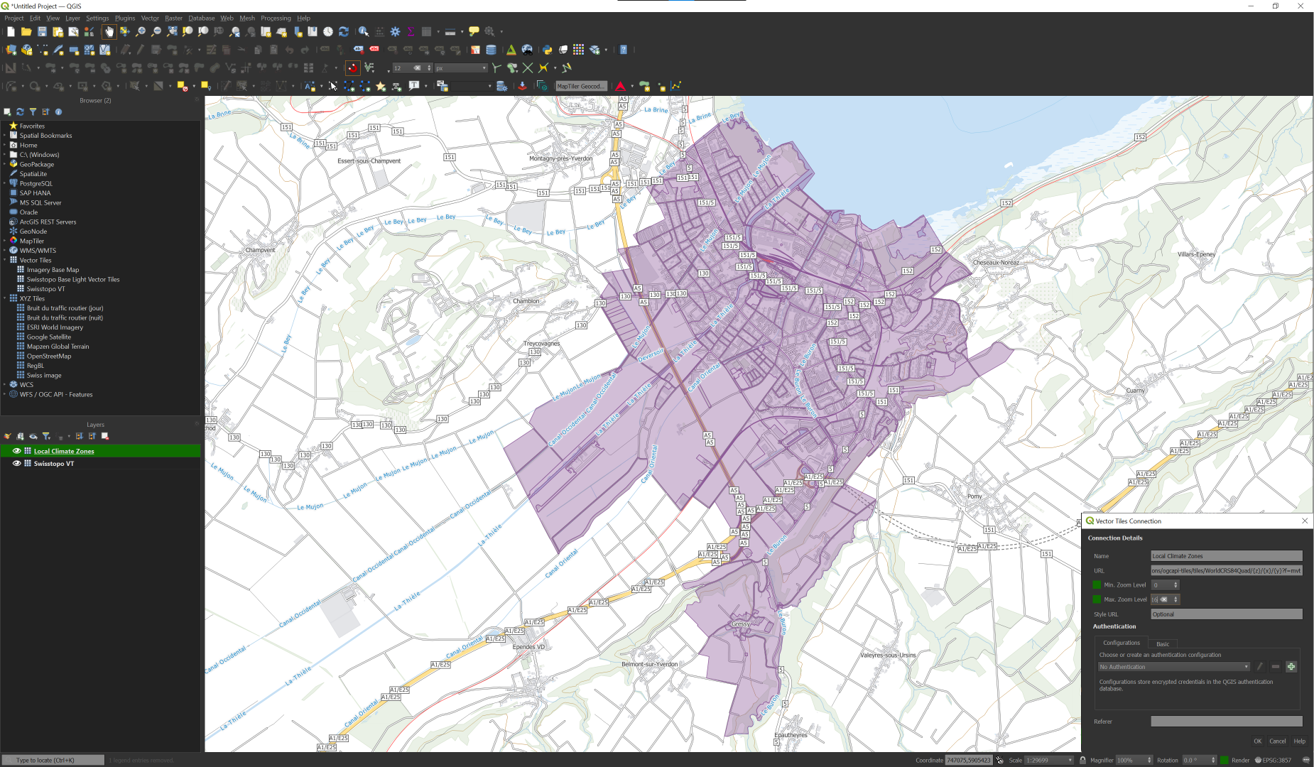
Follow these steps to connect to a service and access vector tiles:
-
locate the vector tiles service on the left hand side browser panel. Note that you can also use the top menu and navigate to
Layer > Add Layer > Vector Tile Layer -
right-click to bring up the context menu and choose
New Generic connection - fill the required values. For URL, use the URL you noted from the previous step, replacing
{tileMatrix}/{tileRow}/{tileCol}with{z}/{x}/{y}. - press
OKto add the service. At this point, if you are using the browser you should see the collection appearing in the menu, below "Vector Tiles" - double-click in the collection to add it to the map
- zoom in to Yverdon-les-Bains to visualize your dataset
Access OGC API Tiles from QGIS through GDAL
Follow the steps to add some collections from an OGC API - Tiles enpoint:
- From the Layer menu, select
Add Layer>Add Vector layer
Tip
Alternatively, you can use the following key combination: Ctrl + Shift + R
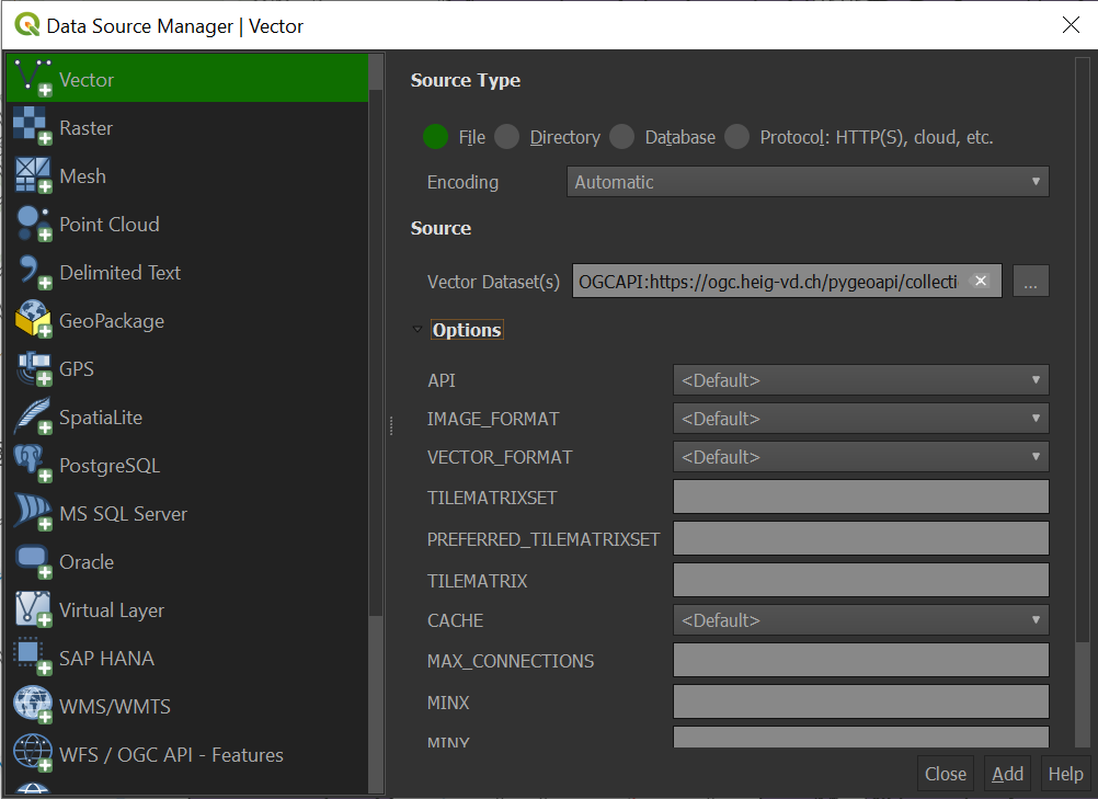
-
For the
Source TypechooseFile -
In the Vector dataset(s) field, provide the
collection_idendpoint (e.ghttps://ogc.heig-vd.ch/pygeoapi/collections/ogcapi-tiles)preceded by the following string:OGCAPI -
Click on the
Addbutton
LeafletJS
LeafletJS is a popular JavaScript library to add interactive maps to websites. LeafletJS does not support OGC API's explicitely, however can interact with OGC API by using the results of the API directly.
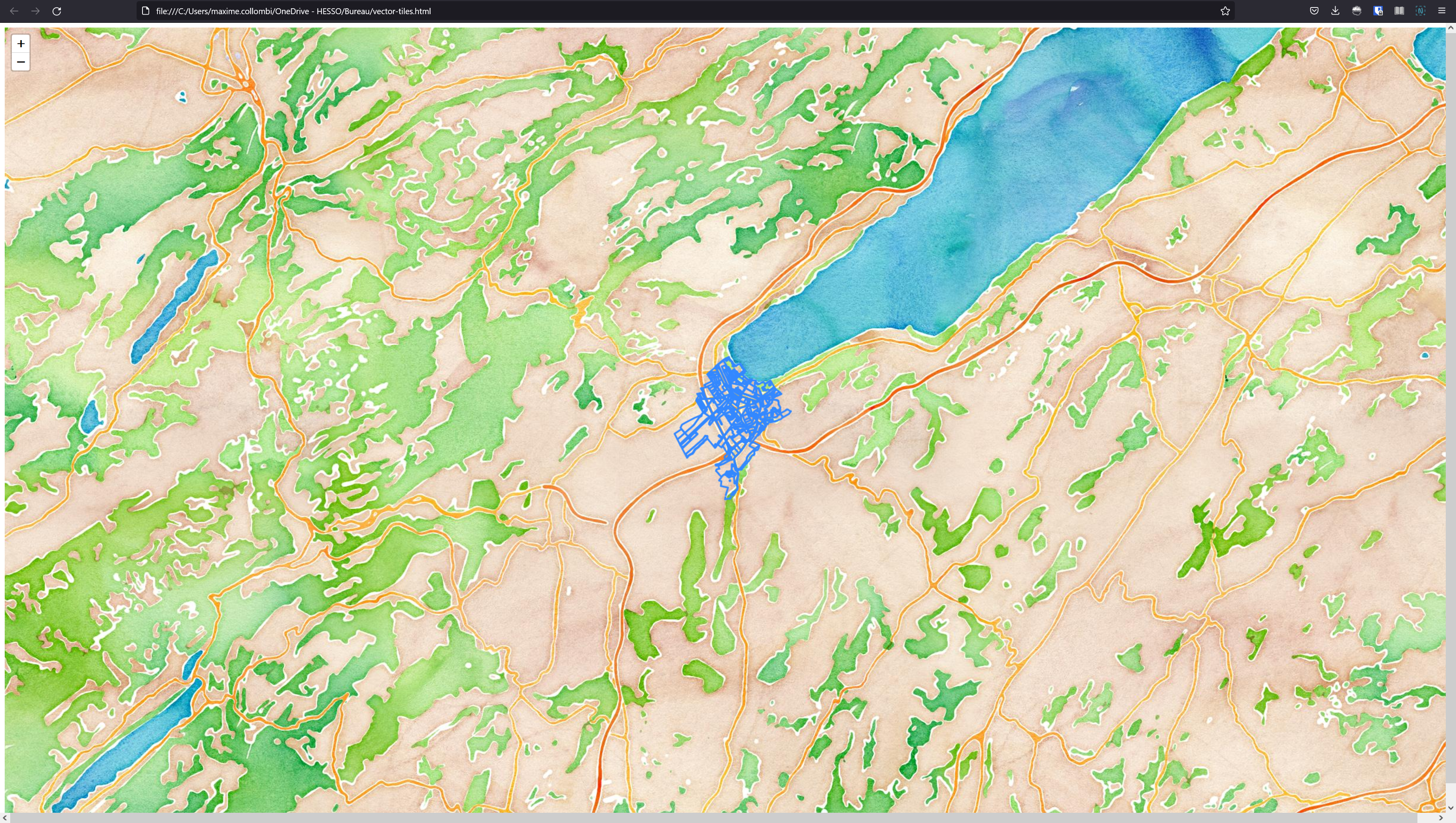
Add OGC API - Tiles to a website with LeafletJS
- copy the HTML below to a file called
vector-tiles.html - open the file in a web browser
The code uses the LeafletJS library with the leaflet.vectorgrid plugin to display the lakes OGC API - Tiles service on top of an OpenStreetMap base layer.
1 2 3 4 5 6 7 8 9 10 11 12 13 14 15 16 17 18 19 20 21 22 23 | |
OpenLayers
OpenLayers is a popular JavaScript library to add interactive maps to websites. OpenLayers natively supports OGC API - Tiles.
Tip