OGC API Features
QGIS
QGIS is one of the first GIS Desktop clients which added support for OGC API - Features. Support has been integrated into the existing WFS provider.
Open an OGC API - Features collection in QGIS
Follow the steps to add some collections from an OGC API - Features enpoint:
- From the Layer menu, select
Add Layer>Add WFS layer - From the
Data source managerpanel, choose 'New connection'
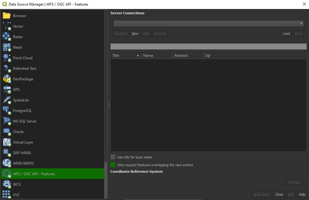 Connexion to an OGC API Features service via QGIS
- Add the URL https://ogc.heig-vd.ch/pygeoapi (or the address of a local server)
- You can now click the
detectbutton and QGIS will notice you are configuring an OGC API - Features endpoint - QGIS facilitates to set page size (request is split in multiple requests)
- for points you can easily set it to 2500
- for some polygons with high density, 100 can already be slow
- Press
OKto save the connection and return to the previous screen - Now click the
Connectbutton to retireve the collections of the service
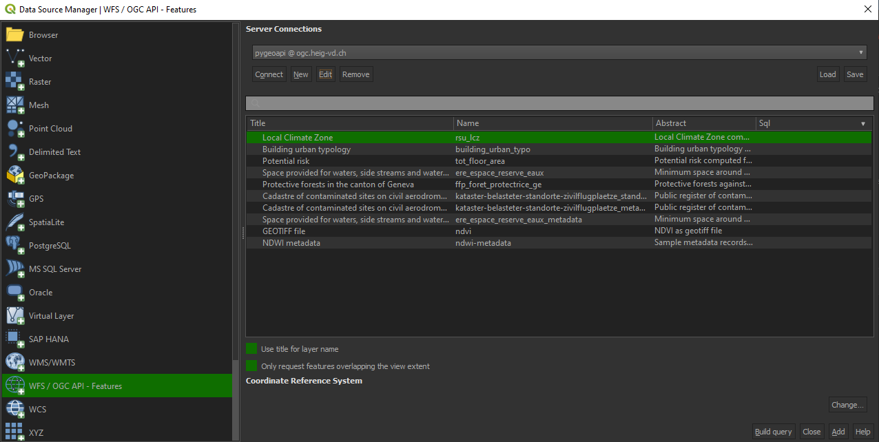 List of collections of an OGC API Features service in QGIS
- You can now add collections to your QGIS project
- You can also build a query to add a subset of the collection
- Close the
Data source manager. Notice that QGIS applied a default styling just like it would if you add a file based layer. You can work with the collection in a similar way; identify, apply styling, filter, export, etc.
Note
Although the above procedure has been explained for pygeoapi, the other services are also accessible via the following urls:
| Service | URL |
|---|---|
| pygeoapi | https://ogc.heig-vd.ch/pygeoapi |
| ldproxy | https://ogc.heig-vd.ch/ldproxy/geoclimate |
| geoserver | https://ogc.heig-vd.ch/geoserver/ogc/features |
| qgis-server | https://ogc.heig-vd.ch/qgis/wfs3/collections/ |
Tip
Install and activate the QGIS Network Logger extension. It will display HTTP traffice within QGIS and is a valuable tool in debugging failing connections.
This can be accessed directly by pressing the touch F12 on your keyboard.
Reference: https://dive.pygeoapi.io/publish/ogcfeat/#client-access
ArcGIS Pro
ArcGIS Pro supports OGC API - Features since release 2.8.
Open an OGC API - Features collection in ArcGIS Pro
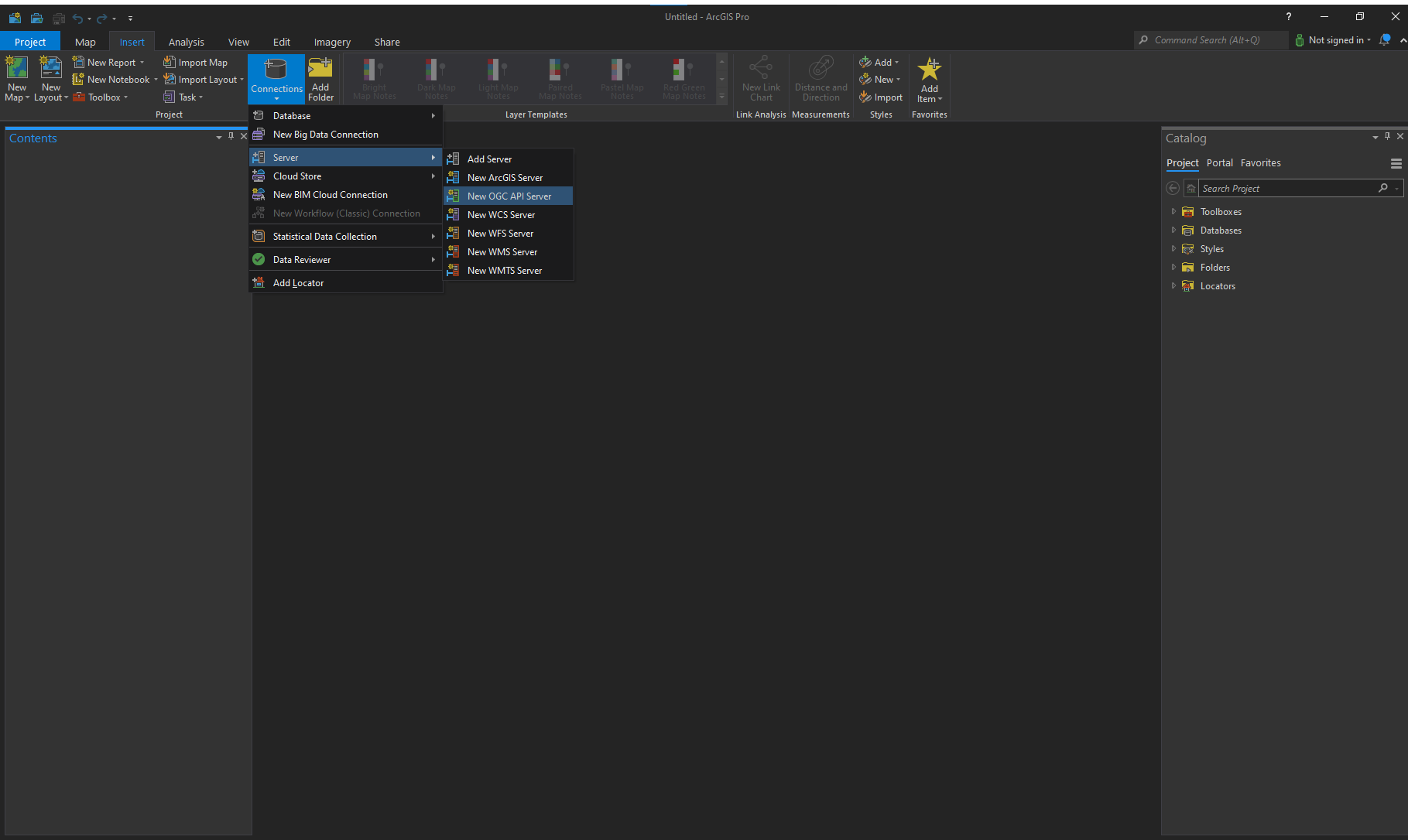
- On the Insert tab, in the Project group, click the Connections drop-down list and click New OGC API Server. The Add OGC API Server Connection dialog box appears.
- Enter the URL of the OGC API server site you want to connect to in the Server URL text box. The URL varies depending on the site configuration.
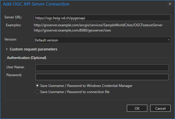
-
Click OK. An OGC API connection file (.ogc) is created and saved in the project's home folder. An item referencing this connection file is added to the project, and the connection appears in the Servers folder on the Project tab of the Catalog pane.
-
Expand the OGC API connection to view the layers present on the OGC API server. Right-click a layer and click either Add to new map or Add to current map to add a layer to the map. You can also add the service to the map by dragging it onto the map or into the Contents pane.
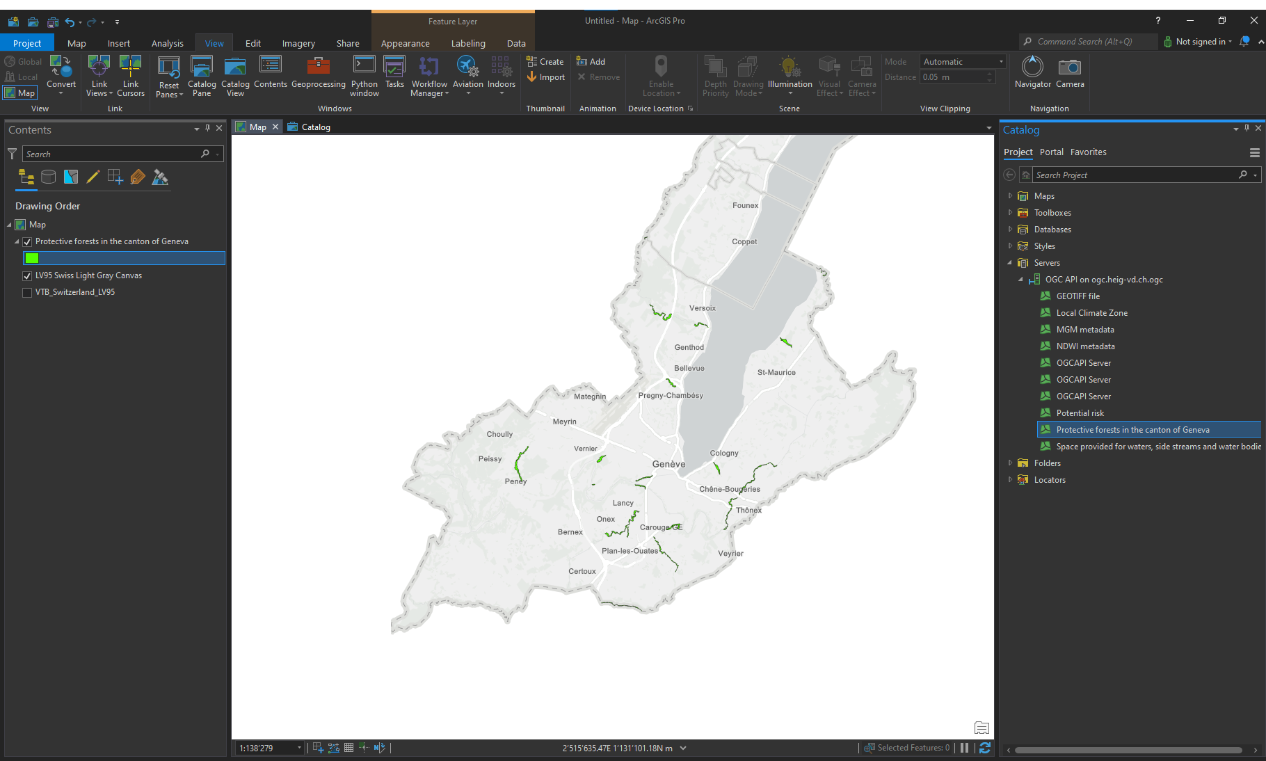
Reference: https://pro.arcgis.com/en/pro-app/2.8/help/data/services/add-ogc-api-services.htm
Build an interactive web maps with OpenLayers
The following steps will show how to create a simple web map with OpenLayers. The map will display the images footprint of the Smapshot API over an OpenStreetMap basemap.
HTML
html lang="en">
<head>
  <title>OGC API Features Open Layers integration</title>
  <meta charset="utf-8" />
  <link rel="stylesheet" href="https://cdn.jsdelivr.net/gh/openlayers/openlayers.github.io@master/en/v6.5.0/css/ol.css" type="text/css"/>
  <script src="https://cdn.jsdelivr.net/gh/openlayers/openlayers.github.io@master/en/v6.5.0/build/ol.js"></script>
</head>
<body>
<div id="map" class="map"></div>
</body>
</html>
CSS
.map {
  width: 100%;
  height: 99%;
  position: fixed;
}
JS
var map = new ol.Map({
    view: new ol.View({
        center: [915801.1809412361, 5909719.679087388],
        zoom: 7
    }),
    layers: [
        new ol.layer.Tile({
            source: new ol.source.OSM()
        })
    ],
    target: 'map'
});

(async () => {
    const features = await fetch(

        // Landing page

        'https://ogc.heig-vd.ch/pygeoapi/'

        // Collections

        + 'collections/'

        // Collections/{collectionId}

        + 'images_footprint/'

        // Collections/{collectionId}/items

        + 'items'

        // bbox (Thun district)

        + '?bbox=7.454385291345676,46.677581212968136,7.867799257607846,46.83661250958942'

        // Pagination & offset

        + '&limit=10&offset=100', {

          headers: {
                'Accept': 'application/geo+json'
            }
        }).then(response => response.json());
  //alert(Object.keys(features.features[0].properties));
    map.addLayer(new ol.layer.Vector({
        source: new ol.source.Vector({
            features: new ol.format.GeoJSON().readFeatures(features, {
                featureProjection: 'EPSG:3857'
            })
        }),
    }));
})();
Live example
Below is a a live example of the above code. Try modifying the Javascript code to display another API endpoint after having forked this pen.
CQL filtering
pygeoapi offers an early implementation of the OGC API - Features - Part 3: Filtering and the Common Query Language (CQL) extension.
Support of CQL is limited to Simple CQL filter and thus it allows to query with the following predicates:
Example
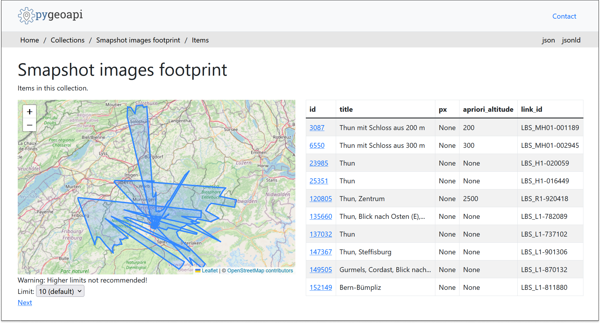
The following url:
https://ogc.heig-vd.ch/pygeoapi/collections/images_footprint/items?bbox=7.454385291345676,46.677581212968136,7.867799257607846,46.83661250958942&filter=CROSSES(footprint,%20LINESTRING(7.63763%2046.755226,7.636992%2046.756444))&f=html
allows to access the following endpoint:
Build your own API Request
Try building your own API request.
You can use any of the clients discussed above as well as your browser.
Tip
The following ressource might be useful if you consider using Spatial predicates: